PARSEC sectors: Energy, Environment, Food
Application fields: Energy & Natural Resources, Industrial, International Bodies, Managed Living Resources, Public Authorities, Services
Keywords: drones, hyperspectral, in situ, IoT, sensors
In the language of Earth Observation (EO), “in situ data” is the common denomination of data deriving from ground-based, sea-borne or air-borne monitoring systems, as well as geospatial reference or ancillary data. In situ sensors can be carried by, among others, air balloons, ground stations, or ferry boxes.
In situ serves validation and calibration of satellite-borne data, and as such are extremely valuable (e.g. in the In Situ Component of the Copernicus programme their use allows acquiring data that satellites cannot due to limited spatial or temporal resolution). Moreover, once Copernicus data is available, in situ can be used to integrate and to build commercial solutions.
In situ sensors, due to their diverse fields of application, are currently a focal point of several very competitive markets (agriculture, marine, environment, energy etc.) and, at least to the extent that they have the readiness to be “plugged in” into networks and communicate within them, have the potential to play a crucial role in Industry 4.0 and the Internet of Things.
Internet of Things (IoT)
Agriculture, smart cities, infrastructure, energy management, and environment are only a few of the possibly endless fields where IoT will thrive. In recent years, in fact, we have observed an explosive growth of devices connected and controlled by the Internet.
It is worth mentioning that the concept of IoT by definition is composed of devices interconnected through a network. However, the different devices may be connected in various types of networks, with regard to their means of exploitation: for instance, against common belief, not all of them could/should be connected to the Internet all the time since (1) some devices have to take instant decisions within a fraction of a second and cannot afford the delay to send the data away to a cloud computer and receive an input (e.g. self-driving cars assessing a possibly dangerous situation), and (2) for others, constant Internet connection may not be needed, for instance, when continuous monitoring and reporting is not necessary, as long as there is a periodic collection of the acquired data.
Despite the increasing trend and exponentially growing number of opportunities for IoT integrated solutions, several challenges remain to be tackled. The vast amount of data generated by IoT prompts the need to develop cloud-computing solutions, and business models shall be created regarding data ownership and data management. This is already prevalent in the EO sector, where the proliferation of platforms is a major driver for the development and delivery of innovative EO-based solutions, which, at an increasing level, rely on in situ sensor data inputs and IoT architectures too. So let’s take a peek at the sensor-side trends.
Hyperspectral is all the hype!
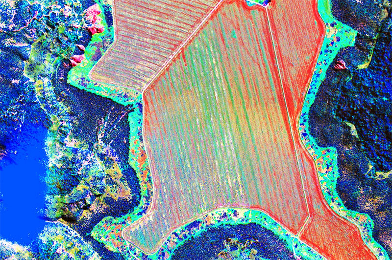
Hyperspectral imagery is one of the most praised trends in EO. Originally developed for remote sensing, it is increasingly used in-situ as well via drones equipped with such sensors. Hyperspectral imaging has confirmed its advantages over the traditional computer vision systems: each pixel contains data from across the electromagnetic spectrum and transmits much more data than an RGB-sensor, and more than multispectral imaging (which only measures a few spaced spectral bands, while in hyper imaging, the measured bands are continuous and contiguous).
The uses of hyperspectral are as abundant as the bands measured:
- In agriculture – crop variety and vegetation mapping, crop disease, stress, and yield detection (chemical composition of plants, pesticides, sugar content)
- Medicine – used in biotechnology, in medicine it can detect early-stage eye disease
- Food processing – e.g. sorting nuts and legumes from stones and sand
- Mining – detect different minerals
- Security – facial recognition
- Environment– land cover, forest health, water quality, surface contamination
The downsides of hyperspectral are elevated costs and processing complexity.
EO Relevance of hyperspectral imagery
While hyperspectral is nowadays used in drones, in satellite observation, multispectral imagery with few channels (ranging to NIR) is considered the high-end norm. Creating an operational satellite system with sufficient ground resolution (less than 10 meters per pixel), good signal-to-noise ratio, and decent revisit times, however, has proven to be a challenge even for government-financed space programmes. They do have hyperspectral sensors in orbit, but with often insufficient for most purposes, spatial and temporal resolutions: PRISMA, SHALOM, Tiangong-1, HYPERION, HISUI, EnMap, NASA’s HyspIRI and HypXIM, etc.
Aside from these missions, the commercial availability of their data, as well as the development of private commercial satellites serving the same purposes, remains to be seen. Hopefully, this may happen in the very near future, as the US already awarded the first commercial contracts for hyperspectral imaging from space.
In the Copernicus programme, Sentinel-2 is equipped with a multispectral instrument. Hyperspectral imagery, on the other hand, may complement the Sentinel-2 data if it is to be made available as a part of the free and open data policy through CHIME (Copernicus Hyperspectral Imaging Mission) in Copernicus 2.0.
In situ is a world of fascinating, diverse and fast-developing cutting edge inventions. If you are aiming at building a viable business model with EO and at staying on top of the competition game, you will certainly need to keep an eye on the uprising in situ related market trends. In the meantime, the PARSEC in situ data hub is the just the right place to dive into already existing in situ solutions!
Leave A Comment
You must be logged in to post a comment.